als@absoluteland.co.nz
 Cell: (027) 237 5011
 Invercargill: (03) 218 7733
 Level 1/19 Yarrow Street, Invercargill
Surveying
- Deformation, Monitoring and Precise Level Surveys
- Redefinition Surveys
- Subdivisions, Boundary Adjustments and Easements
- Topographical Surveys
Whether a survey requires 0.1 millimetre or 10 centimetre accuracy our surveyors are experienced with various deformation, monitoring and precise level surveys. A few of the types of deformation and monitoring surveys are:
- Industrial Measurement Surveys - such as Housing and Industrial Developments, Services Information.
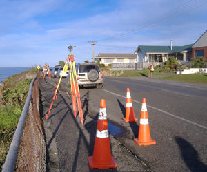
- Building Sites Under Load - including roads, pipelines, railways, and bridges.
- Land and Structural Stability Issues - including interior floor plans, elevations and sections, and BOMA surveys.
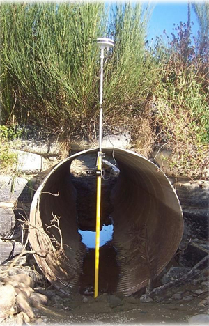
- Precise Levelling - such as Flood Plains, river banks and river, lake and sea beds.
Our survey crews are equipped with modern data capture equipment capable of dealing with the need of the specific project.
We can provide the data in digital form (most formats), paper form, or both.
All work is undertaken under the guidance of a Licensed Cadastral Surveyor.
Please contact us if you require any further information.
Whether building a fence, retaining wall, shed, garage or house, we can give the assurance that the structure will be put in the right place, preventing disputes and further costs down the track.
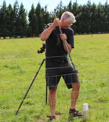
As part of the process our surveyors search for all the latest survey and title information. They then mark your boundary positions, with a stake, survey pegs or boundary disks. Data is part processed on site to confirm that accuracy criteria are being met, then transmitted to one of our staff for final processing.
We also provide a diagram giving the relationship between the pegs and the surrounding fence lines, buildings, or other notable topographical features.
Please contact us if you require any further information.
Our highly experienced surveyors seek to work alongside our clients to achieve their goals Having Licensed Cadastral Surveyors on staff enables us to undertake all your subdivision and boundary adjustment needs. Some of the types of subdivision and boundary adjustment surveys we deal with are:
- Rural Subdivisions - such as the subdivision of farms, lifestyle blocks, surplus dwelling subdivisions.
- Residential Subdivisions - such as quarter acre further subdivision and green field developments.
- Boundary Adjustments - including adjusting the boundaries to match fence lines and buildings.
- Unit Title Surveys - for new and existing houses and apartments.
- Cross Lease Surveys - for new or existing dwellings.
- Lease Surveys - including BOMA, mineral and area leases.
- Easement and Right of Way Surveys - such as for power, telecom, water, sewerage and rights of way.
Our survey crews are equipped with modern data capture equipment, to make the process as accurate and cost effective as possible.
Based on the experience gained all over New Zealand, our licensed cadastral surveyors are adept at mobilising in any location, whether remote or crowded, to undertake projects regardless of the scale.
Data is part processed on site to confirm that accuracy criteria are being met, then transmitted to one of our staff for final processing.
We complete all the planning, surveying and engineering requirements, and lodge all survey information with Land Information New Zealand.
Please contact us if you require any further information.
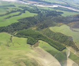
We undertake a variety of topographical surveys. Types of topographical surveys include:
- Detailed Site Surveys - such as Housing and Industrial Developments, Services Information.
- Route Surveys - including roads, pipelines, railways, and bridges.
- Measured Building Surveys - including interior floor plans, elevations and sections, and BOMA surveys.
- Surveys of Topographic River Features - such as Flood Plains, river banks and river, lake and sea beds.
- Volumetric Surveys - of Quarries, Coal stocks and Spoil tips.
Based on the experience gained throughout the world, our surveyors are adept at mobilising to remote and inhospitable locations to undertake projects large and small.
Data is part processed on site to confirm that accuracy criteria are being met, then transmitted to one of our staff for final processing.
We can provide the data in digital form (most formats), paper form, or both.
All work is undertaken under the guidance of a Licensed Cadastral Surveyor.
We are happy to help you with your project, please contact us for a no obligation chat and/ or quote.