als@absoluteland.co.nz
 Cell: (027) 237 5011
 Invercargill: (03) 218 7733
 Level 1/19 Yarrow Street, Invercargill
Land Subsidence & Slippage
Land Subsidence and Slippage Monitoring, and Topographical Data Collection
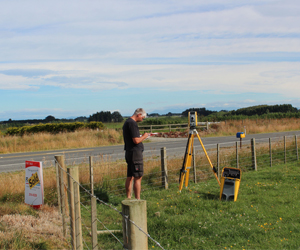
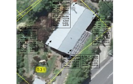
A number of properties were located over an area of land that had started to subside and slip after a period of sustained rainfall. This required ongoing monitoring of the houses, and a topographical survey.
The client required a topographical survey to be undertaken identifying the gradient of the land, the location of cracking and an identification of the main features around the properties.
After this initial survey, a number of points were chosen on the existing buildings. Using these points and measuring with a reflectorless total station, we were able to determine and provide, information about the direction and rate of movement.
Please contact us for all your monitoring and topographical data collection requirements.